KASPER · ASSET TRACKING
One Tracker. Many Industries. Total Asset Visibility.
Satellite-backed protection for mobile equipment, marine fleets, and high-value assets.
Kasper is built for organizations that manage valuable assets across changing environments. From vessels and trailers to remote equipment and service vehicles, it keeps location, movement, and status visible in one place. With autonomous solar operation and global satellite coverage, teams get dependable tracking where traditional systems often fail.
Key Features:
Solar Powered
Runs for years on sunlight alone. No batteries to swap, no charging cables, no forgetting.
Built for Marine Abuse
Sealed against salt, rain, and full submersion. Designed to outlive the gear it’s tracking.
Real-Time Location
Position updates via Inmarsat satellite. Works in parking lots, on boat lifts, at anchor, in motion.
Fits Everything That Floats or Rolls
PWC, tenders, kayaks, paddleboards, trailers, outboards. If it’s worth stealing, it’s worth tracking.
Long Battery Backup
Internal battery covers extended cloudy weeks and long winter storage. Reliable year-round.
One Map, Every Asset
Your main vessel, your tender, your jet skis, your trailer, all on one screen in the GOST Specter app.
Meet Kasper:
Engineered to perform in any environment.
Specifications:
COMPACT. SOLAR POWERED. VISIBLE FROM ANYWHERE.
One App. Every Asset.
From the dock to the dirt road, every Kasper-tagged asset on a single screen.
The same satellite trackers protecting your vessels also follow the equipment that lives on land. One login. One map. Watercraft and machinery, named and visible.
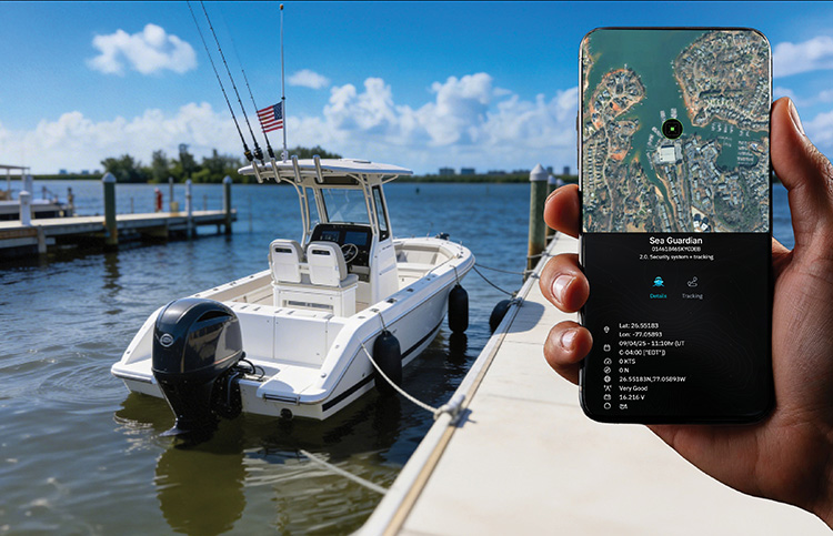
Marine Fleet
Every boat, every PWC, every tender — named.
Tap any vessel for live position, last known speed, and geofence status. Works at the slip, on the lift, mid-ocean.
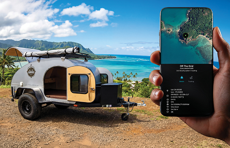
Land Assets
Equipment, trailers, containers — all on the same map.
Heavy equipment, parked trailers, jobsite gear — wherever it ends up, satellite reporting keeps it on the grid.
Visibility When It Matters Most.
Compact. Solar Powered. Visible from anywhere.
A solar-powered global satellite tracker for every land and water asset — pre-staged, box-ready, and dispatched the moment disaster strikes. Monitor location, status, and movement of every deployed unit through a single, centralized application.
Traditional infrastructure & cellular networks are often non-existent or overloaded in disaster zones. Kasper isn’t.
Box-Ready
Pre-Staged
Global Reach
Always-On
HERO-Cert
Hazard Safe
Plug & Play
Rapid Install
Mobile
Centralized App
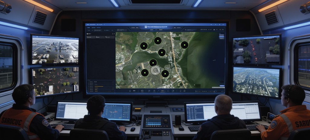
Total Situational Awareness
Designed for fast-moving operations in unpredictable environments.
When hurricanes and storms hit, communication infrastructure is the first thing to fail. Kasper units are pre-staged and dispatched instantly to disaster zones for real-time coordination of every rescue asset, on land or water.
Centralized Visibility
Real-time location data for every deployed asset, accessible from any mobile device or command station.
Satellite Connectivity
Two-way communication via Inmarsat and Orbcomm — coverage where cellular networks have failed.
Intelligent Monitoring
Track utilization, dwell times, and receive automated alerts for secured equipment and supplies.
Geo-Fence Protection
Define operational zones and get instant alerts when assets move beyond set boundaries.
Centralized Asset Visibility
One platform.
Total deployment awareness.
Monitor deployed assets through a centralized interface designed for operational awareness across land and water-based missions. Review location, movement, and status from desktop or mobile, keeping teams informed wherever deployment takes them.
Deploy Quickly.
Track Globally.
Respond With Confidence.
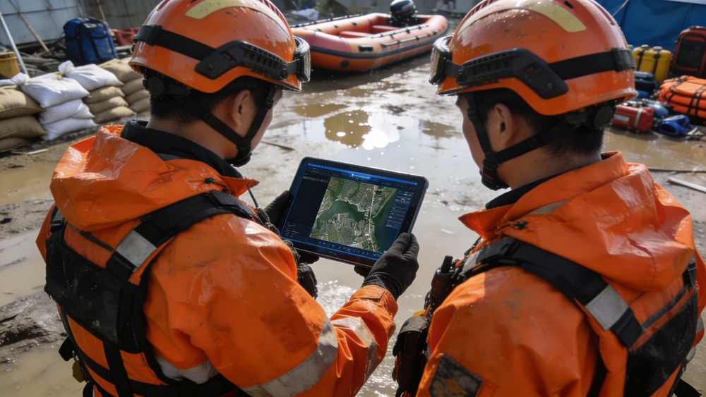
Deployment Use Cases
- Hurricane & storm response
- Flood operations & disaster relief
- Search & rescue team tracking
- Small-boat fleet visibility
- Temporary field deployments
- Remote equipment monitoring
Certifications
FCC/IC · CE RED · ATEX Zone 2 · CID2 · ROHS · WEEE · HERO
Box-Ready · Pre-Staged
Ready to Deploy in Minutes, Anywhere.
Pallet-ready Kasper SAR units stage in advance of season — shipped, tested, and ready to dispatch the moment a call comes in. No installer truck-roll, no provisioning queue. Open the box, hand it to the team, start tracking.
<5 min
Install
Solar
Powered
Global
Satellite
Stop Hoping Your Boat Is Fine.
Talk to a GOST specialist about what it takes to protect your vessel over satellite, and sleep through the night.
Purchase Kasper Now